- Home
- News
- What’s On
- Activities for Children
- Arts & Crafts
- Autos and Bikes
- Business events
- Car Boot & Auctions
- Charity events
- Churches & Religious
- Comedy
- Dance
- Days out & Local interest
- Education
- Exhibition
- Film
- Gardening & Horticulture
- Health
- Markets & Fairs
- Music
- Nature & Environment
- Spiritual
- Sport
- Talks and Discussions
- Theatre and Drama
- Business
- Local Information
- Jobs
- Deaths
- Charity events
- Contact Us
Long-distance footpath for National Park
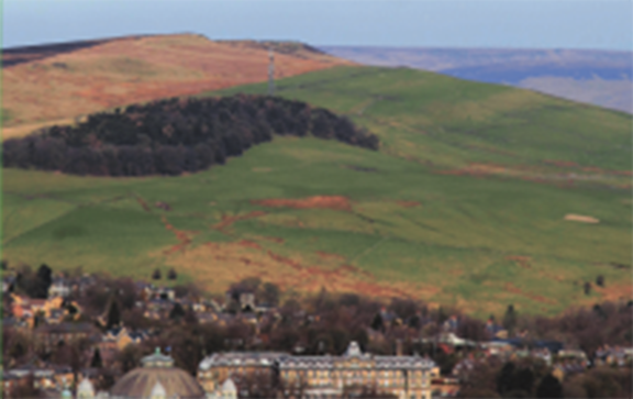
A new long-distance footpath, celebrating Britain’s original National Park, has been launched by Friends of the Peak District.
The 190-mile route stretches from South Pennine moorlands to the gentle limestone scenery of the Derbyshire Dales, embraces the urban edges of Sheffield and Oldham and takes in the rugged moorland of Staffordshire and the undulating slopes of Cheshire.
It was launched in a ceremony in Buxton, attended by ceramics designer and manufacturer Emma Bridgewater, who is national president of the Campaign to Protect Rural England (CPRE).
Peak District National Park chief executive Sarah Fowler also attended the event, along with mayors from authorities throughout the area.
During the day, teams of walkers completed 20 stages of the walk, ‘first-footing’ the course in its entirety. The walk is the brainchild of Julie Gough, a keen walker and Friends of the Peak District’s fundraising and marketing co-ordinator.
Over the last two years, Julie and other Friends members have worked with volunteer walkers and writers to complete the project, which has also been funded by Tesco’s Bags of Help scheme and Marston’s Brewery.
“One of the reasons for devising the route was to raise awareness of the edge of the National Park and its magnificent landscapes – and to encourage people to cherish and protect them,” says Julie. “The walk follows existing paths and trails and takes you away from the usual ‘honeypots’, into quieter, less well-known corners of the Park, giving you a new perspective on the Peak District.”
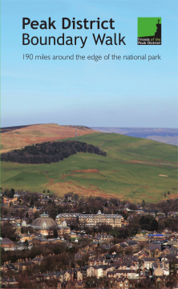
A new guidebook to accompany the walk has also been launched, edited by Peak District National Park member and outdoor writer, Andrew McCloy. The ‘Peak District Boundary Walk: 190 miles around the edge of the national park’ highlights many of the historical and current challenges faced by the Peak District and how the Friends have fought to protect it.
The team effort to map the walk and write the book echoes how the National Park boundary was originally mapped in the late 1930s by teams of volunteers from all around the Peak District, co-ordinated by the CPRE in Sheffield. The boundary they proposed is largely the one we have today.
Peak District National Park chief executive Sarah Fowler commented: “This project brings the past into the present. Just as those who originally mapped the boundary decided it was a landscape worth protecting, today we are encouraged to enjoy the National Park and to care for it for future generations.”
You must be logged in to post a comment Login