- Home
- News
- What’s On
- Activities for Children
- Arts & Crafts
- Autos and Bikes
- Business events
- Car Boot & Auctions
- Charity events
- Churches & Religious
- Comedy
- Dance
- Days out & Local interest
- Education
- Exhibition
- Film
- Gardening & Horticulture
- Health
- Markets & Fairs
- Music
- Nature & Environment
- Spiritual
- Sport
- Talks and Discussions
- Theatre and Drama
- Business
- Local Information
- Jobs
- Deaths
- Charity events
- Contact Us
Best walks in Cheshire on your doorstep
From the shaded paths of Macclesfield Forest to the open vistas of Bosley Cloud and Three Shires Head, Cheshire’s countryside is a walker’s paradise – here are a few favourites to get you started.
Cheshire covers an area of 905 square miles and at the last census recorded a population of around 1 million people – a large number of these live in the county town of Chester.
Perhaps the best-known feature of the county is the Cheshire Plain, a large expanse of flat lowland, yet there are many other landscapes within Macclesfield that lure walkers from miles around.
Here are a few favourite walking routes, from canal and riverside pathways, to winding tracks through forests and moors.
Three Shires Head
6.2 miles/10km | 4 hours | moderate
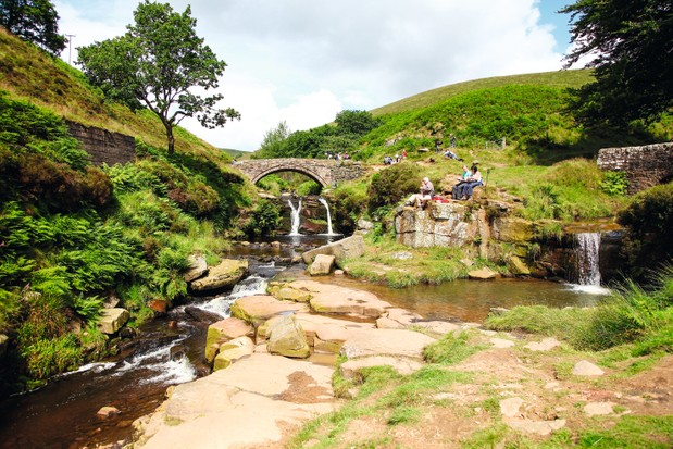
In England there are an astonishing 68 county tripoints, but perhaps none as lovely as Three Shires Head where Staffordshire, Derbyshire and Cheshire converge in an isolated Peak District valley.
Here, two bridges span the meeting of waters, a duo of waterfalls cascading over rocks to gather in mountain-cold plunge pools. Hikers, photographers and wild swimmers are all drawn to this beauty spot, so it’s best to come early in the day. Enjoy an invigorating swim, a hot drink and the first rays of the summer sun before continuing on your figure-of-eight hike.
Three Shires Head walking route and map
Tegg’s Nose
7.5 miles/12km | 4 hours | moderate
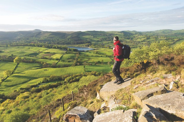
Just 20 miles from Manchester city centre, the precipitous Tegg’s Nose Country Park represents an abrupt end to the Cheshire Plain, with flat fields replaced by a whole new, wild landscape of steep, craggy hills, open moors and dense, impenetrable forest.
It’s here where the imagination can run wild as you trek along the woodland paths, with nearby place names such as Wildboarclough giving a clue to the beasts that once roamed here. Various stories link the name Tegg’s Nose back to early Norse settlers, while others connect it to the word teg, a name for a two-year-old sheep, with the nose moniker easily linked to the promontory at the southern end of the ridge.
Tegg’s Nose walking route and map
Gawsworth
5.4 miles/8.7km | 3–4 hours | moderate
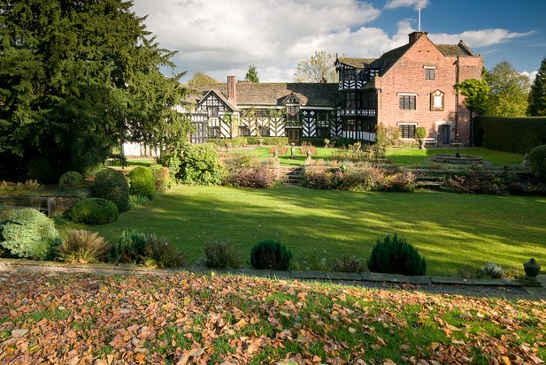
Gawsworth hosts a trinity of features that define an English village – old church, medieval hall and classic pub. The church is at one end of the village-centre fishponds; the eye-catching old ‘magpie’ hall at the other.
Such Englishness deserves a spectre; cue the ghostly form of a lady dressed in green seen abroad in the lanes, church and hall. She is said to be the shade of Mary Fitton, the Dark Lady of Shakespeare’s sonnets and member of the local gentry.
A spinney at the edge of the village is known as Maggoty Wood, after Samuel ‘Maggoty’ Johnson, England’s last professional fool or jester. He was buried in the wood in 1773 and his ghost dances among the trees. Last but not least, the Harrington Arms is a memorable ghost of what all village pubs must once have been like.
Gawsworth walking route and map
Macclesfield Forest
6 miles/9.6km | 4 hours | moderate
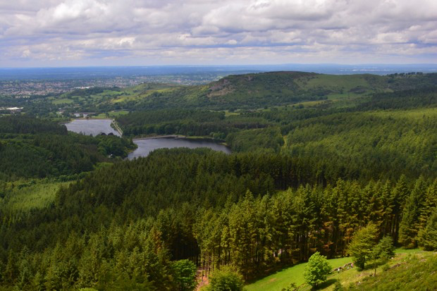
Spring is the perfect time to explore the remnants of the Norman hunting forest high above Macclesfield, where an abundance of birds and woodland flowers, including bluebells, will remain in the memory.
Firm tracks and paths draw you upwards through mixed fir and broadleaf woods to moorland edge pasture, generously endowed with views to nearby Shutlingsloe and the great ridge, topped by Cheshire’s highest point, Shining Tor.
Macclesfield Forest walking route and map
Middlewood Way and Macclesfield Canal
8.5 miles/13.8km | 5–6 hours | moderate
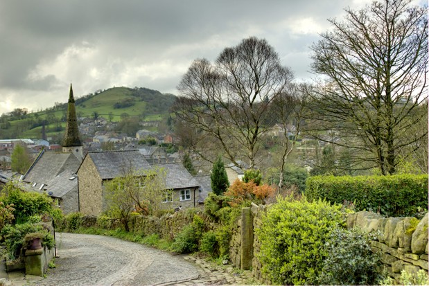
The Cheshire Plain ends abruptly in a jumble of ridges and knolls that rise steeply into the Peak District. Threading along this divide are two contemporary transport arteries that today offer some idyllic, easy walking or cycling in glorious wildflower-rich countryside – a mosaic of woodlands, cloughs and pastureland rich with industrial heritage.
At its heart is trendy Bollington, which grew as a cotton town in late Georgian times, booming after the Macclesfield Canal opened in 1831. Huge mills developed beside this waterway curving above the town. The imposing Clarence Mill stands at one end of a remarkable embankment and aqueduct, one of the most notable achievements of Britain’s canal builders.
Middlewood Way and Macclesfield Canal walking/cycling route
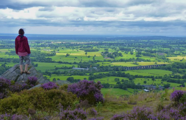
Bosley Cloud
2.5 miles/4km | 1.5 hours | moderate
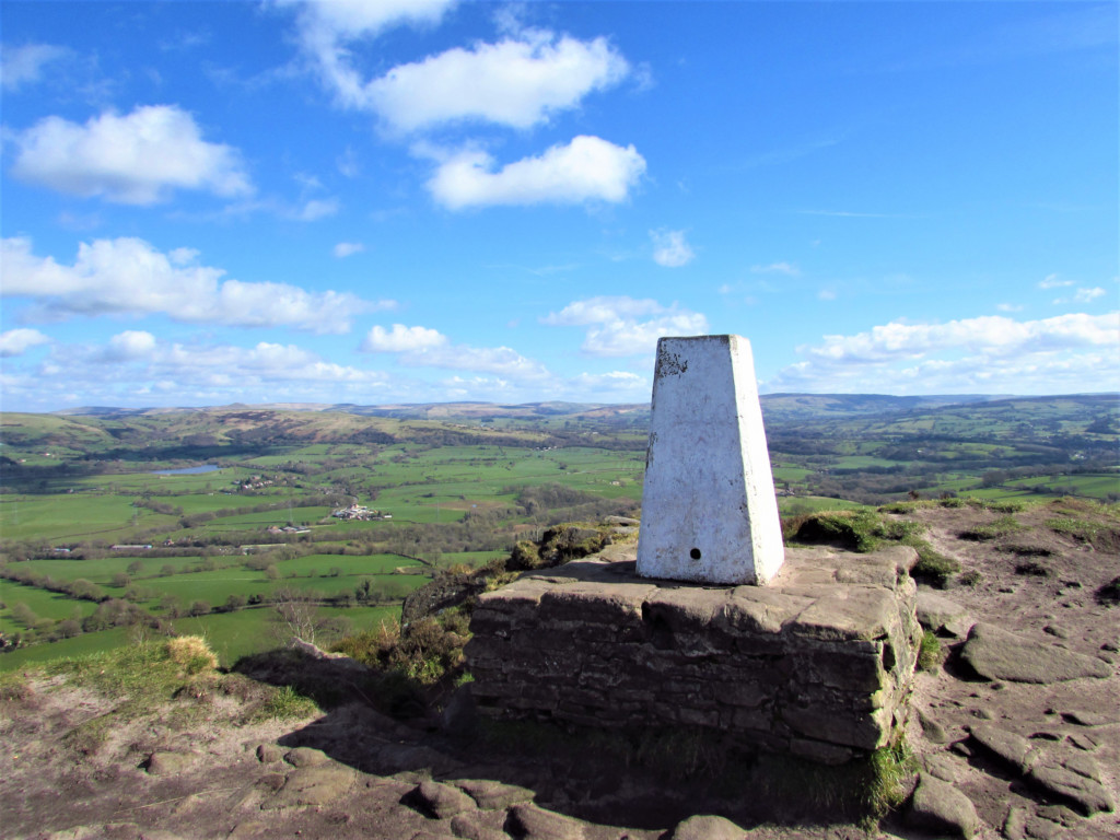
At the summit of Marilyn-classed Bosley Cloud (343m), you feel on top of the world. Take in views across the Cheshire Plain – Congleton Viaduct, Rudyard Lake and Jodrell Bank – to Greater Manchester and the encircling Peak District. Follow the toposcope and pick out Liverpool Cathedral 38 miles away. You can even bag the trig point. And if there is a dusting of snow on the patchwork, so much the better.
A 2.5-mile circular walk on the Gritstone Trail starts at Timbersbrook picnic site – once a silk mill, now a pond for toads frequented by herons and kingfishers. Turn left on to Tunstall Lane, right up 365 steps through hoar-frosted woodland, and across heathland.
Check out some more beautiful Cheshire walks: https://www.countryfile.com/go-outdoors/walks/best-hikes-in-cheshire/
You must be logged in to post a comment Login